Sorsogon, at the southeastern part of the Bicol Peninsula, is bounded on the north by the province of Albay, on the east by thePhilippine Sea, on the south by the San Bernardino Strait, and on the west and northwest by the Ticao and Burias Passes. It has a total land area of 2,119 km2. It is characterized by an irregular topography, and, except for landlocked Irosin, all the towns lie along the coast. They are all connected by concrete and asphalt roads. Mountains sprawl over the northeast, southeast and west portions. Mt. Bulusan, the tallest peak, rises 1,560 meters above sea level. Except for its overland link with the province of Albay to the north, it is completely surrounded by water. Sorsogon is the gateway of Luzon to the Visayas and Mindanao through its Roll-on/Roll-off ferry terminal facilities located in the municipalities of Matnog, Pilar and Bulan. Below are the Main tourist attractions in Sorsogon.
Lake Bulusan
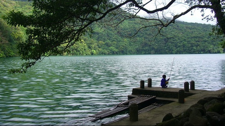
Bulusan Lake is surrounded by a secondary growth forest that is home to a number of butterfly and bird species. Approximately 41 tree species have been identified in this surrounding forest.There are no streams or rivers that visibly flow into the lake. The major source of water is considered to be seepage from underground water surrounding the lake. Also, surface runoff contributes to the lake volume, but only during the rainy season.
Subic Island, Donsol
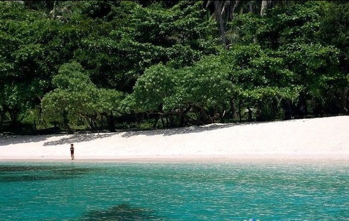
Of the islands in Matnog, Subic distinguishes itself by being the only one with pinkish sands, earning it the moniker La Playa Rosa (the Rose Beach). Aside from the pink sands, this Sorsogon dive site is also highly valued for the coral reefs around it, which are populated by some of the most exotic and diverse aquatic life forms in the continent.

Custom Search
Calintaan Island
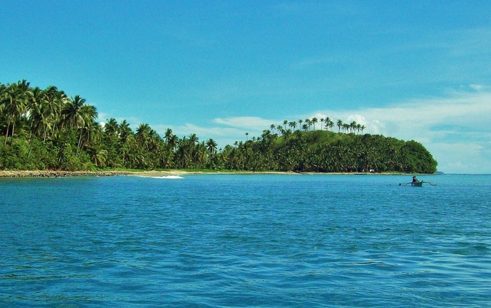
Calintaan Island is a favorite of Sorsogon dive site aficionados, and is another of the lands that make up the Matnog group of islands. The island itself is renowned for its impressive rock formations and caves, but it is the waters around it that grab attention, mainly due to its vast underground caves and other imposing rock promontories.
Tikling Island
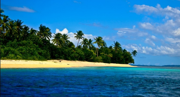
The island, nearly circular in shape, has a few small hills, one of which is some 180 feet in height partially covered in natural bush, providing a shaded walk. The hillsides provide a water run-off area that is stored in old disused rice paddies of some 10 has. This fresh water area provides a haven for water birds.
